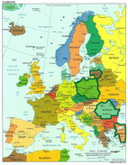
Regional
Information:
Hunedoara, Transylvania, Romania
Hunedoara county is situated
in the centre-west Romania
in the province of Transylvania
and has an area of 2,712 sq
mi (7,025 sq km).
Lying on the mid Mures-river
course the county is guarded
by the Western Transylvanian
Alps (Apuseni Mountains) in
the North, Orastiei and Surianu
mountains in the South-East,
the Retezat Mountains, the
Godeanu, Valcan and Parang
Mountains in the South and
the Poiana Ruscai Mountains
in the South-West.
Hunedoara county is crossed
by the rivers Strei, Raul
Mare (Big River), Crisul Alb
(White Crish), and Jiu and
has two large depressions,
the Hatzeg Country (Tara Hategului)
and Zarand Country (Tara Zarandului).
The fertile river valleys
and the rich hills and mountains
made possible a very intense
life pulsating since ancient
times.
Historical evidence, particularly
rich and old, begins with
traces of human habitation
since early Palaeolithic times
to the second half of the
Iron age. This was the cradle
of the Dacian (Thracian tribes)
civilisation with a complex
of fortresses from the Orastiei
Mountains, Piatra Rosie and
Banita, the Roman conquest
and the Daco-Roman civilisation.
During the reign of King Decebalus
, the capital of the kingdom
was situated at Sarmizegetusa
Regia , today the ruins of
Gradiste. After the Daco-Roman
wars and the Roman conquest
(105-106 AD) the capital moved
to Ulpia Traiana Sarmizegetusa
, in the Hatzeg Country (Tara
Hategului). Pre-state formations
emerge during the 1st millennium
at Deva, Strei, Dobra, Hunedoara.
At the beginning of the XIII
c. Hunedoara became an independent
county at the border between
the Principality of Transylvania
and the Banat region.
Among historical personalities
born in the Hunedoara county
one can mention, John Huniady
(Ioannus Corvinus, Iancu de
Hunedoara, cca 1387-1456)
Prince (Voevode) of Transylvania,
Count of Temes, Ban of Severin,
and father of King Mathias
I Corvinus of Hungary (Matei
Corvin), then Nicolaus Olahus
(1493-1568) a mediaeval humanist
scholar, Ioan Budai Deleanu
a representative of the Transylvanian
Scholastic Movement (Scoala
Ardeleana), the great inventor
and engineer Aurel Vlaicu,
pioneer of modern aviation
and many others.
The area is rich in useful
minerals, gold and silver
ore from the Western Transylvanian
Alps have been worked since
Roman times, and the Romans
used the natural thermal waters
from the spas of Geoagiu,
Calan and Vata de Sus. Non-ferrous
ores are also abundant in
the Brad area, known as Metalliferous
Mountains. Iron ore and coal
extraction from Poiana Ruscai
Mountains and Jiu Valley mirrored
the English Industrial Revolution,
Hunedoara county was one of
the first European regions
where cast iron and later
steel were industrially produced
since the XIV-XV centuries.
Hunedoara county has three
main cities (municipia), Deva
, Hunedoara and Petros,ani,
ten medium towns, 57 parishes
and 460 villages and a total
population of 550,800 (1996
est.). With a vast tourist
potential, Hunedoara county
offers a variety of attractions,
a historical rich culture
with a variety of sites of
great natural beauty. The
Retezat National Park is located
in the Retezat Mountains,
a natural reserve area exceeding
275 sq mi (700 sq km.), with
over 60 peaks over 7,500 feet
(2,300 m), more than 80 glaciary
lakes (the Bucura Lake is
the largest with over 11 ha),
also rare and endangered alpine
flora and fauna species, breathtaking
scenery.
The
Saint Nicholas Church
of the village of Densus,
Hunedoara, Romania is one
of the oldest Romanian churches.
It was built in the 13th century
in the place of a 2nd century
Roman temple, with some materials
taken from the Dacian Sarmisegetusa
fortress. It features a stone
tower above the naos. Inside
the church there are 15th
century mural paintings which
show Jesus wearing Romanian
traditional clothes.
At Densus exists a bizarre
but very elegant church. It
is very near from the former
Roman Dacia capital - Colonia
Ulpia Traiana Augusta Sarmizegetusa.
This strange building from
the Hateg County was the object
of many controverses between
scientists, eager to find
its origines. Some had considered
that the church was fisrt
a mausoleum for Roman general
Longinus Maximus, killed by
the Dacians; others that it
was a temple for Mars god;
Nicolae Iorga said that the
monument dates from 14th century,
and art historian Vatasescu
in the last quarter of the
13th century.
Many investigations were made.
But the monument is still
keeping his mistery. On assume
the the old church was modified
along the centuries, specially
at the end of the 13th. Build
from river rocks, bricks with
Roman inscriptions, funerary
stones, canalisation, etc.,
taken from Ulpia Traiana,
the Densus church has a bizarre
aspect, being admired but
also looked with astonishment.
In the interior some fragments
of painting are kept. The
paintings from the upper naos
and altar are signed by the
artist Stefan (signature that
can be seen till today) and
are revealing the great artistic
skills of the master. The
features of the painting send
us to those of the St. Nicolae
Church from Curtea de Arges,
built in the 14th century.
The resemblance is telling
us that a master from Vallachia
was present here in Transylvania
Geography
This county has a total
area of 7,063 km². Hunedoara
county lies în South-Western
Transylvania, bordered by
Apuseni Mountains (North),
Orastie and Surianu Mountains
(South-East), Retezat Mountains
(South), Poiana Ruscai Mountains
(South-West) and crossed by
Mures, Rau Mare, Strei, Crisul
Alb and Jiu rivers, with large
depressions such as Zarand
and Hateg. Retezat National
Park and other pictoresque
regions makes it one of the
most beautiful counties in
Romania.
History
Its history begins along
with the Dacians, who built
a strong defensive system
of fortresses in Orastie Mountains,
nowadays part of UNESCO World
Heritage. After the Roman
conquest, the capital of Dacia
province was also established
here, in Hateg depression,
named Colonia Augusta Ulpia
Traiana Dacica Sarmizegetusa,
last name after the former
Dacian capital. After the
Romans left Dacia, the first
pre-feudal entities apperead:
Deva, Strei, Dobra, Hunedoara.
After the Hungarian conquest
of Transylvania, Hunedoara
became a county.
During the Middle Ages, in
the town of Hunedoara, the
Corvins, a powerful Romanian
feudal family from Transylvania,
part of which is King Matthias
Corvinus of Hungary, founded
the most important Gothic
style secular building in
Romania - The Corvins Castle.
The capital of the county
is Deva. Other important cities
are Hunedoara, Petrosani,
Orastie, Hateg and Brad. Petrosani
is a very important city in
Romania nowadays, being the
key town in Jiu Valley, a
very delicate Romanian area,
due to its numberous unemployed
former miners.
List of cities in Hunedoara
county: Hunedoara, Deva, Petrosani,
Vulcan, Lupeni,
Petrila, Orastie, Brad, Calan,
Simeria, Hateg, Uricani, Geoagiu,
Aninoasa
Twenty kilometres southeast
of Hunedoara is HATEG , the
gateway to Transylvania's
greatest Roman remains and
one of the most convenient
approaches to the Retezat
mountains. In addition to
the ruins, you'll find a a
bison reserve 3km north, and
a number of interesting Romanesque
churches in the area immediately
around Hateg, all of which
are reasonably well served
by local buses from the center.
Santa
Maria Orlea
3 km from Hateg on the road
to Petrosan you will past
an old and small villages.
The first building of historic
interest which the end-users
must focus on is the very
Kendeffy mansion in Râu
de Mori. According to historical
information, it was first
built of stone in the second
half of the l5th century.
At that time, that was the
foremost family of gentry
about those places, standing
out through their fortune
and social ambitions. As from
the l6th century, they were
known only as the Kendeffys.The
building in the South-Western
corner of the complex served
as the Calvinist chapel of
the family and their servants.
On the South-Eastern side,
not too far away, there is
the vicarage in Râu
de Mori.Mentioned in documents
in 1526, it has undergone
several changes, thus losing
its initial look. Close to
its entrance, on the left
hand side, flat on the ground,
there is one of the most interesting
tombstones in Hateg, with
inscriptions on reused Roman
marble, going back to 1505
and brought there from Colti
Monastery
Ulpia
Traiana Sarmizegetusa
The antic city had an area
of 32 ha surrounded by walls.
In the hearth of the city
were to main roads (cardo
maximus oriented North-South
and decumanus maximus oriented
East-West), at its crossing
being the main public building
- Forum. But the city was
not only inside the walls.
Outside the walls, on a great
area, were the villae, the
craftmen workshops (brick
makers, glass blowers), the
temples and other public or
private buildins. Also outside
the walls were the cemeteries
of the city (sepulcreta) identified
at East and also at the West.
The population was around
25.000 - 30.000 people.
Amphitheatre
Situated at about 100 meters
from the norhten side of the
city wall, the ampfitheatre
is the most big construction.
In it's elliptical shape,
it is build on a high and
leveld place, it is 88 m long
and 69 m width. It's capacity
crowd is about 5000 people.
The primary material witch
it was build with is river
rock and on other places canion
rock and bricks. The date
of the construction is not
knowed precisely, but it's
estimated that it was built
in the first years after the
roman conquer. Restauration
works were done in 158, witch
is proved by the date on the
roof tiles that were found
by the researchers.
The amphitheatre is composed
from two parts: the arena
with some paralell elliptic
wals, perpendicularely crossed
by some other wall, in ray
shape. It had two main gates
(east&west) witch were
used by the gladiators to
enter and exit, and another
two gates with marble coloums,
for the workers.
In the middle of the arena
there was a kind of sewer
pipe, from witch was there
able to get water.
After Dacia was abandoned,
the building was used as a
fort to defend against the
atacks from the migrating
people.
Forum
The forum build by Traian,
the civic and political-administrative
center, was in the middle
of thee town, at the cross
road ot the two main roads
which crossed Sarmizegetusa
from East to West and from
North to South.
Its entrance was monumental
and had the aspect of a triumph
arch on which was graved the
inscription from the colony
foundation. In the front of
the entrance, bordered by
four huge columns was the
altar dedicated to the foundation
ceremony. On both sides were
artesian wells made from marble
and decorated with statues.
In the corners were the offices
of some associations, as the
handicraftsmen board which
was in the Eastern corner.
The forum was composed first
of all from a public square
surrounded by the porch with
columns and paved with lime
and marble. In this square
were many monuments and statues,
some of the foundations are
seen today. After that was
a basilica, a big hall for
several mettings, which have
had a monumentale facade towards
the yard, bordered by buttress.
On the Eastern side of the
basilica was a tribunal, the
platform on which the judges
were sitting (most of the
time the two mayor of the
town) and under which a prison
was arrranged. On the basilica's
side there were several rooms
that were offices (ex. the
archieve of the colony), as
well as offices of some associations
and corporations as was the
augustals board. In the center
of the side was the curia,
the metting hall of the local
council. Under it are two
underground rooms, which were
the thesaurus of the town.
On its right is a passage
to the second forum (initally
the commercial market), which
was built later and which
was the religious centre of
Sarmizegetusa.
The
Muzeum
Situated over the road of
ruins, there are many artefacts,
discovered during the archaeological
researches.
Many artefacts are in other
museums, in Cluj – Napoca,
Bucharest, Budapest, Wien
or Berlin.
Prislop Monastery
From the county of Hateg is
a place of recovering and
meditation. Prislop Monastery
had enjoyed the grace of three
saints and it had three founders.
The history of the monastery
started at the end of the
14th century, when the Saint
Nicodim built this place.
It was the third place built
on Romanian ground. The monastery
was built on glade near the
Retezat Mountains, where rise
a stream, which in 1564 proved
to be miracle making.
In the year 1959 the monastery
is was closed by the communists.
Only in 1976 the place is
taking his statute of nun
monastery.
This momastery is theological
seminary of girls. The nuns
guide the young girls to studi;
they continue to paint icons
after the art of the old ones,
to weave carpets in which
you can find the old folk
Romanian motifs.
Another Christian mission
of these places is "The
Home of Saint"- a cave
dug nobody knows how it was
done in hard stone three hundred
years ago. In this cave lived,
for many years, in fast and
prayers Saint Ioan from Prislop.
The right word is that Prislop
Monastery can be considered
a success.
The Colt citadel
(loose translation: Citadel
of the Sharp Peak) is a pictoresque
castle atop of a steep cliff
dominating the beautiful the
villages of Suseni and Râu
de Mori in the historic Râusor
valley, at the bottom of the
Retezat mountains, was a fortified
feudal castle, property of
the Romanian cneji family
Cândea. The citadel-castle
contains a storied tower with
2 m thick walls (the donjon),
in it’s front two more
polygonal towers, connected
with the moat and access bridge.
It was the most powerful citadel
in the Hateg Country. The
castle was built in the 14th
century and it was still used
in 1684.
At the bottom of the castle,
lies its medieval chapel,
nowadays the chapel of a little
monastery.
The castle was made famous
by the french writer Jules
Vernes which after visiting
the region was inspired by
the dramatic setting of the
castle and wrote he novel
"The Castle in the Carpathians".
The Roman Ruins
After conquering Dacia, the
Romans started developing
the country to suit their
needs. They were especially
interested in the gold, for
which the Dacian mountains
were legendary. So they expanded
the mines that the Dacians
were using for centuries and
started some new ones. The
new Roman administration and
the quite large army needed
to ensure the peace in the
newly conquered region needed
new cities and camps. So the
Romans built dozens of them
all over Dacia. The most important
of them was the capital of
now Roman Dacia, Ulpia Traiana
Sarmizegetusa. The similarity
with the name of the former
Dacian capital is not an accident.
The new town was built a few
kilometers from the old one.
It was a big town, with all
the features of a Roman town.
It has streets, aqueducts
and temples. The Romans had
a long period of flourishing
in Dacia, but after less than
200 years they had to abandon
the region, due to the weakening
of the Empire. Inevitably,
the town of Ulpia Traiana
fell apart.
Nowadays, you can still explore
the ruins of this ancient
city, on the road, about 20km.
from the city of Hateg. The
place is now an archeological
site, and a small museum shelters
some of the beautiful sculpted
columns and statues discovered
here. The bulk of the sculptures
uncovered here now lies in
the Museum of History in Bucharest.
The Hateg Citadel (Subcetate
) is located 4 km SE of the
city of Hateg, in the village
of Subcetate perimeter. The
archeologists found dacic
remains and remains of the
Cotofeni culture also. It’s
not excluded that Petru, comite
of Hateg and great royal comite
in 1276, had something to
do with the citadel. In 1317,
the donjon, the moat and the
dirt defense wave. Destroyed
in 1420, it was rebuilt in
1430. In 1536, the citadel
loses it’s value falling
slowly into rouin.
The Retezat
Slightly lower than the Fagaras,
these superb mountains lie
in the Western part of Romania,
close to the cities of Petrosani
and Deva. They are the site
of Romania's only national
park, covering more than 140,000
acres (56,000 hectares). The
spectacular mountain scenery
and countless crystal-clear
glacier ponds are a must see
for any mountain hiker coming
to Romania.
Retezat can best be accessed
from the North. The trail
will lead you right up to
the chalet Pietrele (``The
Rocks"). After that,
a strenuous hike reaches the
great lake at Bucura. This
is the true center of the
massif and a favorite camp
site. Around this vast caldera,
one sees the whole beauty
of these mountains - on one
side, there is the highest
local peak (Peleaga), while
on the other side lies the
perfect cone of the Retezat
peak. All around, hundreds
of small ponds scattered among
fields of huge boulders reflect
the summer sky.
Starting at the lake, one
can reach all the important
attractions of these mountains
in one-day hikes. A trip to
the East, past the Peleaga
peak, will take you toward
the magnificent pond at Galesu
("The luring one")
and the sharp, spectacular
passage at Portile Inchise
("The Closed Gates").
On the other side of the huge
valley, you can enter the
National Park, with its untamed
wilderness. This trip will
require a special pass, but
the hike is definitely worth
it, as you can take a peek
at the wildlife - among others,
the rare mountain goat or
chamois as well as unique
species of mountain flowers.
If you are a rock climber,
Retezat will not disappoint
you, with many trails spanning
all levels of difficulty,
with the extra twist of unforgetable
views
Tara Hategului ( Hateg Country)
In the south part of Transylvania
is laying the depression Tara
Hategului, this land including
a big plat of land with fields
of wheat and old Romanian
villages. In the north east
part of Hateg is the river
Galbena flowing. In the N-E
part is laying Slivut forest
where the tourists can visit
the aurochs reservation. Anywhere
in the in the town if you
are turning your look at south
you will see the Retezat mountains.
In the Retezat mountains have
comming one of the most important
river in the country, where
was build seven artificial
lakes wich are producing electricity
for the county Hunedoara.
Hateg is a very old town this
fact is also confirmed by
an old document from 1247,
which reminds of a “Romanian
land, known as Terra Harszoc
(Hateg Country)”, older
than it’s first documentary
attestation. The special natural
conditions determined the
life of the daco-roman population
and then Romanian population
take place uninterrupted.
In many villages around Hateg
you can find historics buildings
and museums like - Sarmisegetuza,
church from Densus, church
from Prislop, fortress Coult,
castle Santa Maria Orlea and
other places like this.
The dinosaur fauna of the
Hateg Basin of Transylvania
(Late Maastrichtian, western
Romania) has been known for
a century. Perhaps the best
represented of the Late Cretaceous
assemblages of Europe, the
Hateg fauna has produced seven
or eight dinosaur taxa considered
to be members of Theropoda,
Sauropoda, Ornithopoda, and
Ankylosauria.
One of the most enigmatic
of these taxa is the ornithopod
known as Rhabdodon. Originally
described as Mochlodon suessi
and M. robustus by Nopcsa
in 1902, these taxa have come
to be regarded as a single
species, R. robustus, distinct
from the species known from
southern France and northern
Spain, R. priscus. In addition
to this taxonomic name changing,
the phylogenetic position
of Rhabdodon has been controversial.
First regarded as a camptosaurid
or iguanodontid, it has also
been referred to Hypsilophodontidae
and considered a member of
the iguanodontian plexus prior
to the evolution of hadrosaurids.
In order to resolve these
issues concerning the phylogenetic
position of this Ha_eg taxon,
we conducted a phylogenetic
analysis of a variety of basal
euornithopods. From this work,
it appears that the Hateg
taxon constitutes two different,
but congeneric species (presently
unnamed), both differing from
R. priscus through the possession
of important synapomorphies.
In addition, the French/Spanish
Rhabdodon and the as-yet-unnamed
Hateg species form a clade
whose sister group is Tenontosaurus
tilletti Ostrom, 1970. On
the basis of our analyses,
we will also discuss the biogeographic
and stratigraphic significance
of the new phylogenetic topology.
Râu de Mori lies in
the centre of a picturesque
depression surrounded by hills
and mountains.
Monuments
of Nature
The Depression Relief
It forms the second highest
terrace (650-700m) in the
Hateg Depression.It consists
of relatively gentle hills
,where the vegetation is basically
natural.A few orchards are
scattered among the massive
hayfields and forests.They
are picturesque places where
you can have a pleasant,comfortable
walk and which are easy to
reach.They have a pleasant
climate.
Mountains
The Retezat Mountains are
some of the most beautiful
Carpathian ranges.They have
relatively high summits,a
very diverse landscape and
above all,a chain of mountain
lakes.Alpine tourism can be
successfully practiced there.You
can admire both wooded zones
and clear views of the valleys
and peaks.The Retezat Mountains
have been compared with the
Höhe Tauern Mountains
in Austria.You can get the
nicest view of the Retezat
Mountains on the Northern
side,that is from Hateg.Râu
de Mori is situated at the
lowest altitude of the mountain
zone(485 m).The highest peaks
of the Retezat Mountains exceed
2,500 m(Peleaga-2,509 m;Papusa-2,500
m).About l/4 of them exceed
2000 m and 2/3 of them are
over 1,600 m high.
The streams springing from
the mountains have nearly
2,000 m high falls;they look
tumultuous and can even form
gorges or waterfalls.One of
them is Râusor,upstream
Suseni,the village neighbouring
Râu de Mori.There are
about 100 lakes in the Retezat
Mountains,mostly glacial.There
are nearly 40 important lakes.Worth
mentioning are:Bucura(2,041
m),the largest and most visited
lake in the Carpathians,Zanoaga(1,997
m),the deepest alpine lake,Custura
Mare(2,270 m),at the highest
altitude in the Carpathian
Mountains,Galesul(2,040 m),Slaveiul(1,970
m),Taul Negru(2,025 m).Glacier
traces can still be admired
in the Lapusnic,Râu
Barbat and Bucura Valleys.
Caves
Those interested in cave tourism
or speleology have two big
groups of caves at their disposal.The
first one is to be found in
the Retezat Mountains.They
lie in the South-Eastern part
of the mountain range and
are easy to reach from the
Petrosani Depression,the last
locality on the way being
Câmpul lui Neag.It it
in those areas that you come
across the largest number
of limestone agglomerates,which
formed the identified caves
and probably other unidentified
and non-classified caves too.They
look very much as a tourist
expects a cave to look like,that
is a scenery with stalactites
and stalagmites.The closest
starting point of your trip
to the caves is the Buta challet.From
there you can get to the Buta
Cave,the "Nail"
Cave,the "Coral"
Cave,the "la Paroasa
" Cave,the Zeicului Cave.None
of them has modern facilities,which
would enable them to be visited.
The second,much more important
group is made up of the caves
in the Sureanu Mountains.You
can reach them starting from
Hateg and passing through
the localities of Galati(16
km from the town of Hateg)
and Pui-Ponor(20 km from the
above-mentioned town).The
best-known of that group is
the Cioclovina Cave and the
caves around the Ohaba-Ponor
village(Sura Mare,Bordu Mare,Tecuri).This
group of caves is protected
by law,because it forms speleological
reserves with guano(a natural
fertilizer produced by bats)
and archaeological reserves(the
oldest Paleolithic habitat
traces on Romanian territory
were discovered there).There
are other smaller caves(Federi,Petros,Ponor)
around the above-mentioned
caves.
The Retezat Reserve
It dates from 1935.It is made
up of the Reserve proper and
of the 130 km long Protection
Zone.You can go into and walk
in the Reserve only with a
special permit.The Protection
Zone is open to tourists,provided
they observe certain vegetation
conservation rules.The Retezat
Reserve boasts a lab-house,close
to Lake Gemenele and three
little check houses at Gura
Zlata,Rotunda and Pietrele.Nature
conservation is very strict
there,crowds are banned and
so are camping,hunting,fishing
or picking up plants.To go
into the Reserve is a priviledge
you can get only if you take
a special interest in getting
to know this extraordinary
natural wealth.
Geological Fossil Deposits
Fossil reptile traces have
been discovered in the Sânpetru,Tustea
and Valioara villages.According
to geological tests conducted
after 1970,it might be a rich
fauna deposit from the late
Cretaceous Period,(around
67 million years-old),a geological
period when dinosaurs lived
too. A nest of eggs and babies
of dwarf dinosaurs called
duck beak dinosaurs was discovered
in the Turstea-Unirea zone.The
samples taken there can be
compared with the better-known
fauna that once populated
North America.The results
which have been given extensive
coverage particulary abroad,have
had a special response not
only among experts.The "Dinosaur
Society" and the"National
Geographic Society"(the
U.S.A.) give a direct support
for research in that area.In
1994,the Sânpetru site
was visited by Jack Horner,the
advisor of film director Steven
Spielberg.A special category
of tourists can join them
into the imaginary world of
Jurassik Park.
Special Flora
Over 970 species of plants
have been catalogued in the
Retezat Mountains alone.4.2%
of them are specific.Let us
mention some of the rare plants
to be found there:the oatgrass,the
white Carthusian pink,the
yellow mountain poppy,the
mountain bedstraws,the edelweiss,the
eight petal dryas,the hair
grass,the yellow lily,the
sweet pea,sorts of gentians,etc.In
Suseni,farther down from the
monastery church,there are
still two edible chestnut
trees.They were part of the
old park of the Kendeffy noble
family.If efforts are made,the
species can be restored,so
that it may make that tourist
zone even more attractive.There
is a small Narcissus Glade
in the Salasu de Sus-Nucsoara
area.Though not very large,it
is fairly well-known,being
visited by tourists when the
flowers bloom.In the Merisor
Pass,close to Petrosani,there
is a wild lilac forest.
Romanian dwarfs
The Transylvanian mountains
were the habitat of mysterious
pygmy dinosaurs, of a size
comparable to present-day
pets. Why these animals from
the Hateg area remained so
small is still not clear;
it may have to do with their
living environment and geographic
situation during the latest
Cretaceous. Based on continuing
research this region, especially
by the Muzeul Civilizatiei
Dacice si Romane at Deva,
the Hateg dinosaurs are among
the best known faunas from
Europe. The Romanian dinosaurs
possibly lived isolated in
small, outpost regions, with
only a limited food supply.
It appears that animals on
islands are often smaller
than their relatives on the
mainland. Then was the Hateg
area a small island? The geology
does not supply any evidence
for this. And... where would
these isolated dinosaurs have
come from originally? Did
they come from the other,
larger European islands or
from the more distant mainland?
Many questions have yet to
be answered.
In the Hateg region the carnivorous
dinosaurs are also diminutive.
The teeth, barely a centimetre
in length, and skull fragments
are of a dromaeosaurid, of
no more than one-and-a-half-metre
from head to toe. These animals
were cunning hunters: the
underside of the roof of this
skull shows an imprint of
the brains. Roughly the size
of that of a cat. In dinosaur
terms, this is an enormous
size: a shrewd dinosaur. Like
the ‘raptors' of Jurassic
Park, dromaeosaurids ran on
their hind-legs and slashed
open the bellies of their
prey with their large sickle-shaped
claws
Just as the previous, Romanian
crocodiles also are not particularly
large; a comparison with the
loose teeth from Oman shows
this well.
The Romanian plant-eating
dinosaur Rhabdodon is closely
related to Telmatosaurus,
and is the commonest Transylvanian
dinosaur. In France, Spain,
and Austria remains of this
dinosaur have been found as
well, so that we may ask ourselves:
did Rhabdodon feel at home
on the relatively isolated
islands of the European Maastrichtian?
It was a selective browser,
but still a large eater. The
wide belly and the position
of the pubis suggest it to
have had a large stomach !
Especially for this exhibition
a model of Rhabdodon has been
prepared. The joint effort
of palaeontologists and preparators
from Romania, France, the
Netherlands and the USA has
resulted in this model. From
the shape of the bones, we
know where the muscles were;
cover these with skin and
then... choose a colour. What
colour did Rhabdodon sport?
Conspicuous? Camouflage? Did
males and females have different
colours? We have opted here
for a camouflage colour, which,
with dromaeosaurid dinosaurs
on the prowl in the neighbourhood,
was probably a very good choice
indeed.
The Ensemble of the Former
Noble Court of the Cândea
Family
The precincts of the former
noble court declared a historical
monument today still preserve
the palace,the chapel,the
stables and the annex.The
noble court lies in the centre
of Râu de Mori on the
bank of the Râusor rivulet,freely
enjoying the splendid surrounding
bird's eye view with the Colti
Fortress watching over the
valley of the rivulet.
a. The Palace
It is an L-shaped building,its
first level being partially
buried in the ground,its spaces
being covered by stone or
brick vaults and with a few
Renaissance stone door frames,which
are the oldest part of the
ensemble(raised on the site
of a previous building)going
back to the 15th century.A
wine cellar and a tea house
will be laid out in the biggest
and most spectacular rooms
on the side parallel with
the rivulet.The basement of
the side perpendicular to
the river will have utilitarian
destinations,including a wine
store-room,processing rooms,kitchens
and the pantry.
În the ground floor
proper-the second level-restored
several times and preserving
spaces covered by Baroque
vaults(probably going back
to the 17th century) on the
side parallel with the river,the
reception desk and various
halls will be laid out,while
the wing perpendicular to
the river will house the restaurant
with the pantry and the toilet.
The last mansard level will
provide the accomodation;some
14 big rooms and suites can
be laid out there with adequate
bathrooms.
The stories are linked by
two staircases lying at the
opposite ends,one being connected
straight with the reception
desk,while a third staircase
links the ground floor to
the halls on the first floor.
b. The Auditorium
It will be laid out in the
former chapel and will be
able to host meetings attended
by 20-30 people,films, music,poetry,theatre
or other recitals,in best
hearing and visibility conditions.
c. The Discoteque
Laid out in the former stables
built in the late 17th century,on
the ground floor,it will consist
of the entrance hall,the dancing
hall,a bar,a cloakroom and
the toilets.The second level
will have a restaurant with
tables and the dancing hall
will be as high as the entire
building.The disco is destined
particularly to the youth
who can be accomodated in
the annex with second-class
facilities.
d. The Annex
The building goes back to
the late 19th century,being
the most modest of the entire
ensemble.
Its ground floor will house
food warehouses,processing
rooms,,a laundry,pantries,an
administrative office,a garage,as
well as the reception desk
with a fast-food for the tourists
staying on the first floor.
On the mansard floor,there
will be four superposed bed
rooms or double rooms with
joint lavatories at their
ends(including showers).Four
rooms,two at each end will
have second-class lavatories.
There are fire escapes at
each end of the building and
the dining-hall is linked
to the hall on the first floor
by a free stairway.
e. Utilities
All the buildings are to have
central heating,each having
its own butane gas-based thermal
power station linked to two
underground tanks in an isolated
area within the precincts.
The used water from the toilets,the
lavatories,the kitchens,the
pantries,the laundries,etc.will
be sewered and dumped into
an emptying pit near the gas
tanks.
There will be inside and outside
electric lighting.
f. Outside Facilities
The two entrances to the precincts
will join a carriage path
leading to the buildings,to
the two parking lots(for the
public and for the employees),to
the garage and to the platform
with the gas tanks and the
emptying pit.
The precincts ground conceived
as a lawn will be planted
with more trees of various
types,flower beds and will
be embellished by pools and
alleys.Playgrounds and sportsgrounds
can be laid out,if necessary
in the area between the disco
and the annex.
Special
Sights
Hunting and Fishing
The fauna is diversified
and wide-spread in all submountain
and mountain areas.The bear
can be hunted in Mount Retezatul
Mic in autumn;the chamoix,numbering
just a few hundred,is protected
by law(it is hunted in Slavei
and Stanuletii Mari);the stag,the
wild boar(in springtime),the
wolf,the fox,the lynx,the
otter,the badger,etc.can also
be hunted in the above-mentioned
zones.The best-known hunting
parks in the Hateg Land are
situated in the submountain
forest zone.In addition,close
to the town of Hateg,the Slivut
forest has been populated
with animals to be hunted.In
terms of special species,they
tried the colonization of
the European bison of Poland,but
no results were obtained.The
roe deer and the pheasant
have been brought and bred
there much more successfully.
The above-mentioned storage
lakes have introduced Hateg
to a world of wading birds.Ducks
have mainly been identified,but
as in the case of fish,no
thorough investigations have
been made to identify new
birds.
All the streams in the Hateg
Land are part of the hydrographic
network collected by the Strei.Since
the waterfall,irrespective
of its origin(from underground
springs or glacial lakes)
is a big one,the streams have
a permanent,rich and high
speed flow along a small distance.These
types of streams are ideal
particularly for trout.Up
to the town of Hateg,there
are no major sources of pollution
which should affect the content
of water and the fish.That
is why,fishing can be practiced
in various places,depending
on the preferences.If you
prefer the mountain streams
with rare whirlpools and with
waterfalls,you would rather
choose the streams coming
down from the Retezat Mountains.The
initial course of the Strei
springing from the Sureanu
Mountains is more gentle.You
can catch trout and umber
in the Râul Mare.The
Lake Trout in the glacial
lakes is 25-30 cm long and
weighs o.500 kg.There are
two trout farms in Hateg,in
Gura Zlata and Zeicani,close
to Râu de Mori.The Rainbow
Trout is mainly bred there.
The storage lakes of the microhydropower
plants on the Râul Mare
provide ideal facilities for
intensive fishing.The biggest
one is at Gura Apei,with a
capacity of 200 million cubic
m and a 173 m high dam.No
surveys have been made about
their fish breeding potential.The
fish population is supposed
to consist of the old fauna
of the component rivers,but
the proportion is unknown.
The license for the exploitation
of the fishing and hunting
zone is released by the Râu
de Mori Forest Administration,that
is in charge of the Râul
Mare,the Râusor,the
Nucsoara and the glacial lakes.
Vivarium lovers can be content
with the amount of insects
to be found in all submountain
meadows and glades.In the
Retezat Mountains,you can
see brightly coloured butterflies
and metal-coloured or big
bugs.Several types of reptiles
live there,among which some
poisonous snakes(the common
adder and the horned snake).The
latter are of interest for
collecting venom.
Sights Related to Local Traditions
The parish fair is regarded
to be "nedeia"that
is"the pastoral festival"
in the respective village.On
that occasion,big gatherings
of the villagers,of the natives
with their relatives and friends.
take place.Perverted in the
last few decades,they have
lost a lot of their initial
meaning and purpose,their
ancestral,lay,even heathen
connotations being sometimes
artificially overdone.An example
is the so-called"ox nedeia"
in Silvasu de Jos(about four
km from the town of Hateg).One
can still see but quite seldom
the traditional folk costumes
during these pastoral festivals.What
has been preserved has suffered
powerful influences from Oltenia(Gorj)
and Banat.
Rural tourism has not been
promoted.And if that happens,it
takes place on a small-scale,accidentally.Even
if there is no longer any
authentic"folk"architectural
dowry,some villages in Hateg
can count on the gentry's
houses.Observing the hygienic-sanitary
norms,those houses specific
to the 18th century-the first
half of our century are unusual
holiday places.The houses
of the former Hateg gentry
and of their descendants are
one-storied stone houses.The
storey is accompanied by a
porch.There are zones where
this type of architecture
is better preserved.The closest
from this point of view is
Clopotiva,about six kilometres
away.Boasting a larger number
of such houses are the Salasu
de Sus,Baiesti,Baru,Unirea,Tustea,Totesti
villages.An interesting type
of folk architecture with
authentic and archaic elements
is still preserved in the
area close to the Poiana Ruscai
Mountains or to the Luncanilor
Platform in the Sureanu Mountain
Range.For instance,we recommend
the Mesteacan village,North
of the Rachitova commune for
the development of rural tourism.The
village will be linked to
the commune by an asphalted
road.
The gourmets passing through
Hateg must make it a point
to taste the Rachitova "tuica"-plum
brandy and"virsli"
made in Salasu de Sus.The
plum brandy has an average
strength.The Rachitova commune
makes impressive quantities
of plum brandy,which might
be bottled with a special
trade-mark by entrepeneurs."Virsli"
are spicy sausages made mainly
of goat meat.They are made
in other villages of Hateg
as well,but the local ads
say the most authentic ones
come from the Salasu de Sus
commune.In the mountain chalets,tourists
are given tea of rasberry
stems and seldom,of dry bilberry
stems.The Hateg beer(Heber)
is considered one of the best
in Transylvania.The "Bacsia"
mineral water,an excellent
and quite competitive mineral
water has been bottled in
Hateg too .
Religious
Edifices
They must be considered
as a special category with
a clear future.The monastic
pilgrimage has always been
extremely thriving for those
who have joined it.The monastic
dowry of the Hateg Land consists
of two major edifices.Prislop
Monastery is one of the oldest
and most stable monasteries
in Transylvania.Few Transylvanian
monasteries can boast such
an old and at the same time
busy history.You can reach
the monastery following the
road from the town of Hateg
to Hunedoara,North-Westwards.From
Silvasu de Jos,the first village
on the way,only 3 km from
Hateg,you have to cover about
seven kilometres to the monastery.Built
in a Wallachian architectural
style,which is quite rare
in Transylvania,it is attributed,according
to tradition,to St.Nicodim
of Tismana,the founder of
monastic life in Wallachia.At
the end of the 16th century,the
monastery was the residence
of abbots,who were also metropolitan
bishops of Transylvania.The
monastery of nuns has greatly
developing,currently including
a high school and providing
accomodation for pilgrims.
Colti Monastery is a monastery
just at the start.It is located
on the ruins of the church
in Suseni(Colti),in the vicinity
of Râu de Mori.There
are arguments in favour of
the cloistral function of
the church,on the basis of
which the current monastery
could be restored.After the
old ruins had been covered,a
few outhouses and facilities
started being built,which
make the monks'monastery in
Colti-Suseni a well-founded
edifice with a future.The
pilgrimage to the monastery
has already started and its
extension greatly depends
on the improvement of roads
and on the ensurance of accomodation
facilities.
Sport Tourism
-Mountaineering.Over 60 pedestrian
alpine routes are homologated,to
which adding up are facilities
for free or winter mountaineers.The
above-mentioned routes have
quite a different level of
difficulty,so that they may
meet most of the demands,from
easy routes to real performance
tests.The Retezat Mountains
are more difficult than the
Bucegi Mountains and easier
than the Fagaras Mountains.Generally,there
are few extremely difficult
sectors.A certain category
of alpine tourists may also
be tempted by some rare routes,marked
by shepherds through the so-called"scarecrows",or
which can be covered only
with guides.The alpine landscape
is far from being monotonous:the
bare rocks in the massifs
or on scree slopes always
alternate with vegetation
of various types,streams with
a rich flow and patches of
snow.
Mountaineers are free to put
up tents in various places
,usually with few restrictions,but
also with the disadvantage
of not finding catering units
and shops or emergency shelters.The
mountain rescue teams,based
both in the town of Hateg
and in the town of Petrosani
are professional,but it is
pretty hard to get in touch
with them and that is done
only through the big chalets
-Skiing and Skating.One can
ski and skate on the lakes
in the Retezat Mountains(skating
however is not practiced due
to the shortage of snow clearing
machinery)in winter lasting
from November until May.Skiing
has been practiced only close
to old chalets,of which the
Pietrele Chalet has played
the main role.In addition
however,there are the chalets
at Baleia and Buta.The access
to those ski tracks is by
far easier than to the chalets
in the Fagaras Mountains for
instance.The extension of
roads has also allowed for
the extension of skiing in
lower mountain zones.One of
the most popular ski zones
now is the one in the Râusor
Valley,as it is easy and fast
to reach,by car or coach included.Neither
the latter,nor the older ones
are officially homologated
and have specific technical
facilities.
-Water Sports.The storage
lakes on the Râul Mare(Ostrov,
Sântamarie Orlea) have
a realatively large surface
and a constant and gentle
flow.They can be used for
rowing in small boats ,in
competitions included.That
is possible provided piers
and marinas are built.
|